The late Robert Dunfield sent me a photograph of what he believes may be be the stone triangle.
For those who don’t know, the triangle was originally discovered by Captain Welling in 1897 then rediscovered by Hedden in 1937 before slipping down on to the shore in the 1960s during excavations.
During the Explore Oak Island Days tour, Danny paused at the location where the stone triangle once was and explained how it was destroyed. Here’s a photo of the position I understand to be where the stone triangle once stood (pay close attention to the horizon).

Here follows the image that Robert Dunfield sent me which he believes shows the stone triangle just beyond the logs. Robert felt that a pile of cut logs was a strange thing to photograph, so decided to look closer.
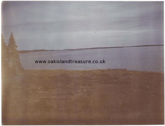
If you match this horizon to my previous photo which we understand to be the location of the stone triangle, you will see that the orientation is almost exactly the same, and it’s even possible to match the topography of the horizon, and even the smaller landmass slightly closer to Oak Island.
So now we can say with confidence that the location in Robert’s photo is certainly the place where the stone triangle once was.
The only original photo of the stone triangle I have to hand is one which Nolan took and appears in Crooker’s book, Oak Island Gold.

Compare the large white boulder in the foreground of the previous image with those by the shore in Dunfield’s picture. Dunfield requested that I did not mark out the specific reference points in the images to see whether you come to the same conclusions. What do you think? Could this photo have captured the stone triangle before it tumbled into the sea?